Terrascape
Making solo hikers feel safer on the trail
Duration
Role
Team
Deliverables
7 weeks
UX Designer + Mechanical Engineer
Maya Chen, Thomas Chen, Ramyani Roy, Chia-Ling Chen
Interaction Design, User Research, Mechatronics Design/Coding
Overview
While solo hiking can be a great experience, the fear of physical assault, injury, and getting lost makes it hard for more vulnerable groups, such as solo women, beginners, and those prone to injuries to use hiking as a means of escape.
This fear became amplified as a result of the pandemic - as public lockdowns were enforced and people flocked to the outdoors, minority groups found themselves struggling to find accessibility in safe, inclusive outdoor spaces. This inaccessibility has actually been coined the Outdoor Diversity Gap.
Initial Exploration
Prior to narrowing our problem space to solo hikers, our original project statement was much broader: reimagining public spaces in light of increasing concerns toward public safety during the pandemic. From 5 interviews and 27 survey responses, here were some of the insights we gathered toward initial lo-fi prototypes:
Anxiety - Hyper-awareness of crimes negatively impacts citizens’ mental health
Fear - People fear the unpredictability of crime more than the crime rate itself
Environment - Physical layout of public spaces has a significant influence on crime
Community - Greater community trust leads to a general reduction in crime
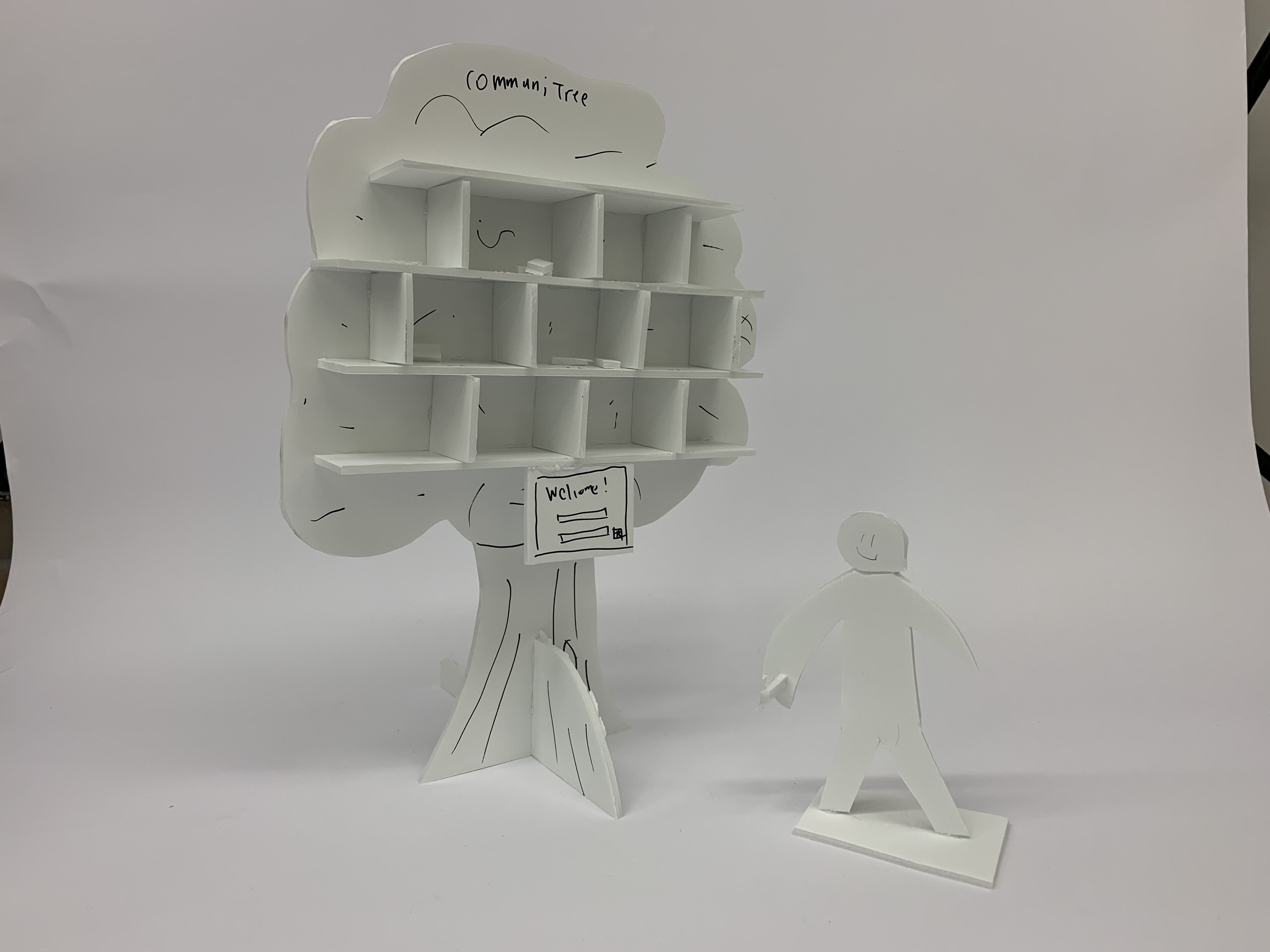
Communitree - a smart mailbox that encourages residents to share gifts and build communal trust
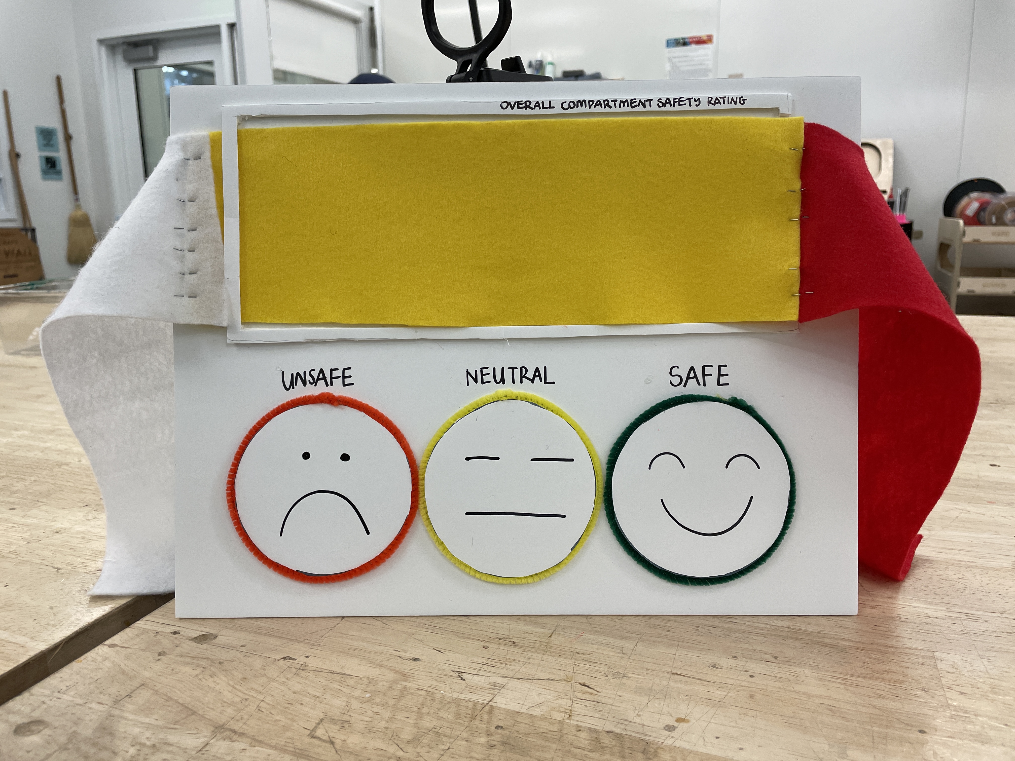
BART Safety Rating - an interactive safety indicator intended for passengers on the Bay Area Rapid Transit (BART)
We received feedback that it was hard to give concise answers because the problem space was too general. Hence, we concentrated on narrowing our focus further - which community were we trying to address? Eventually, we stumbled across an interesting problem space popularized by the pandemic: hiking.
An Activity Popularized by the Pandemic
Between 2019 and 2020, the number of hikes logged increased by 171.6%. Additionally, the volume of individual hikers increased by 134%. We wanted to look further into who these individuals were, and how the pandemic affected their perception of safety in the outdoors. Here are two profiles that we formed from interviewing solo hikers:
"I’ve had some traumatic experiences in the past. Whenever I go out alone, I have a general fear of being watched and not knowing what’s around me"
- Unexperienced Female Hiker
"I just want the assurance that help will be there when I need it - how do rescuers know how to locate people in the wilderness without reception?"
- Experienced Solo Hiker
Feedback also revealed that physical tracking devices were preferred over phone apps, as the tangibility and specialization of the device gave them a sense of greater assurance and reliability.
Prototyping + Testing
From the prototypes we created, users were drawn towards safety and privacy, peace of mind, and the idea of having a community to rely on while hiking.
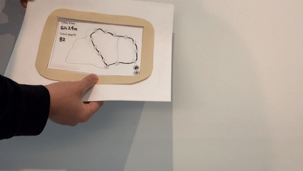
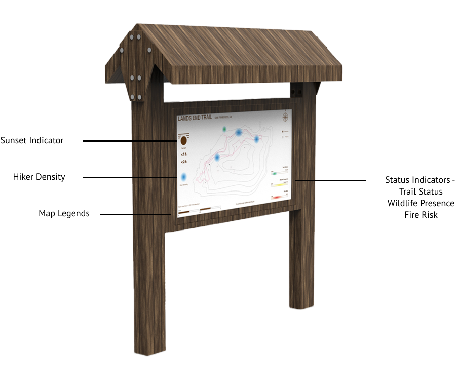
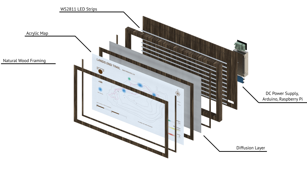
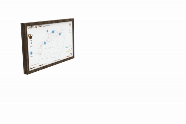
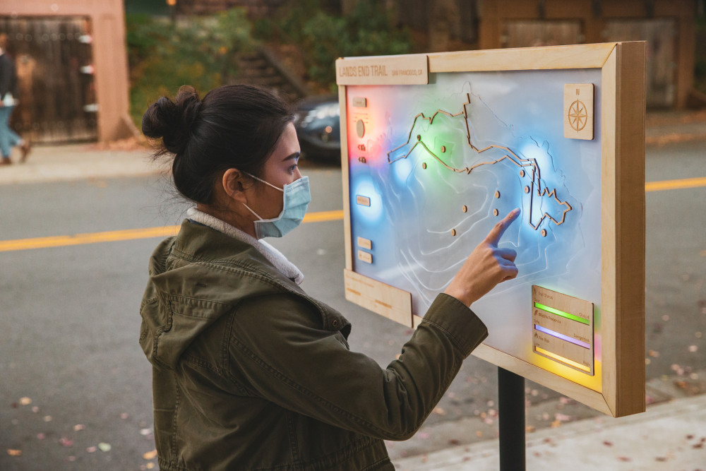
Hiking Dashboard
An alternative to analog trailhead maps, able to communicate live trail conditions through live visualizations such as trail conditions or weather forecast
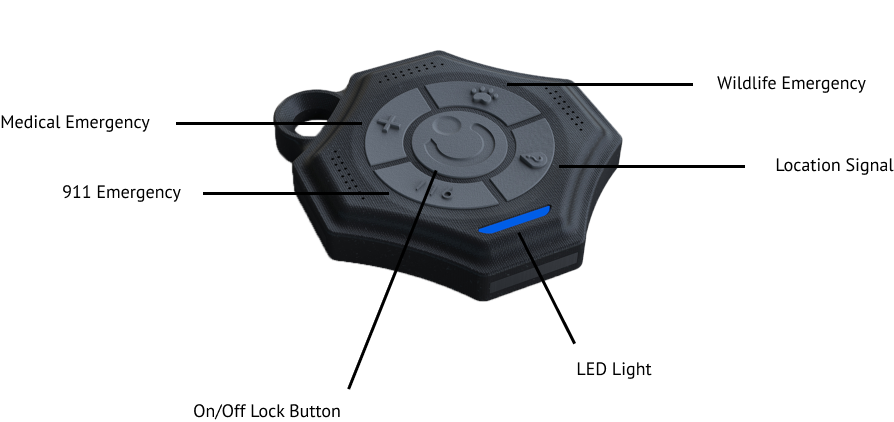
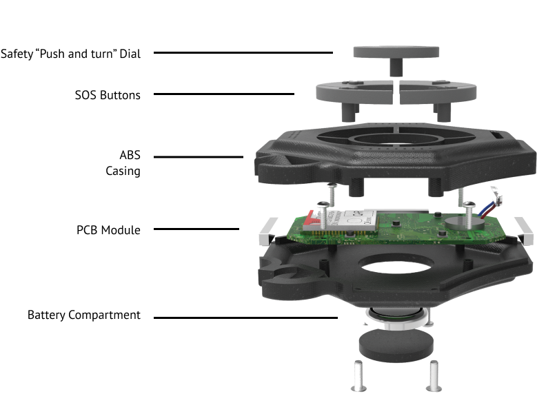
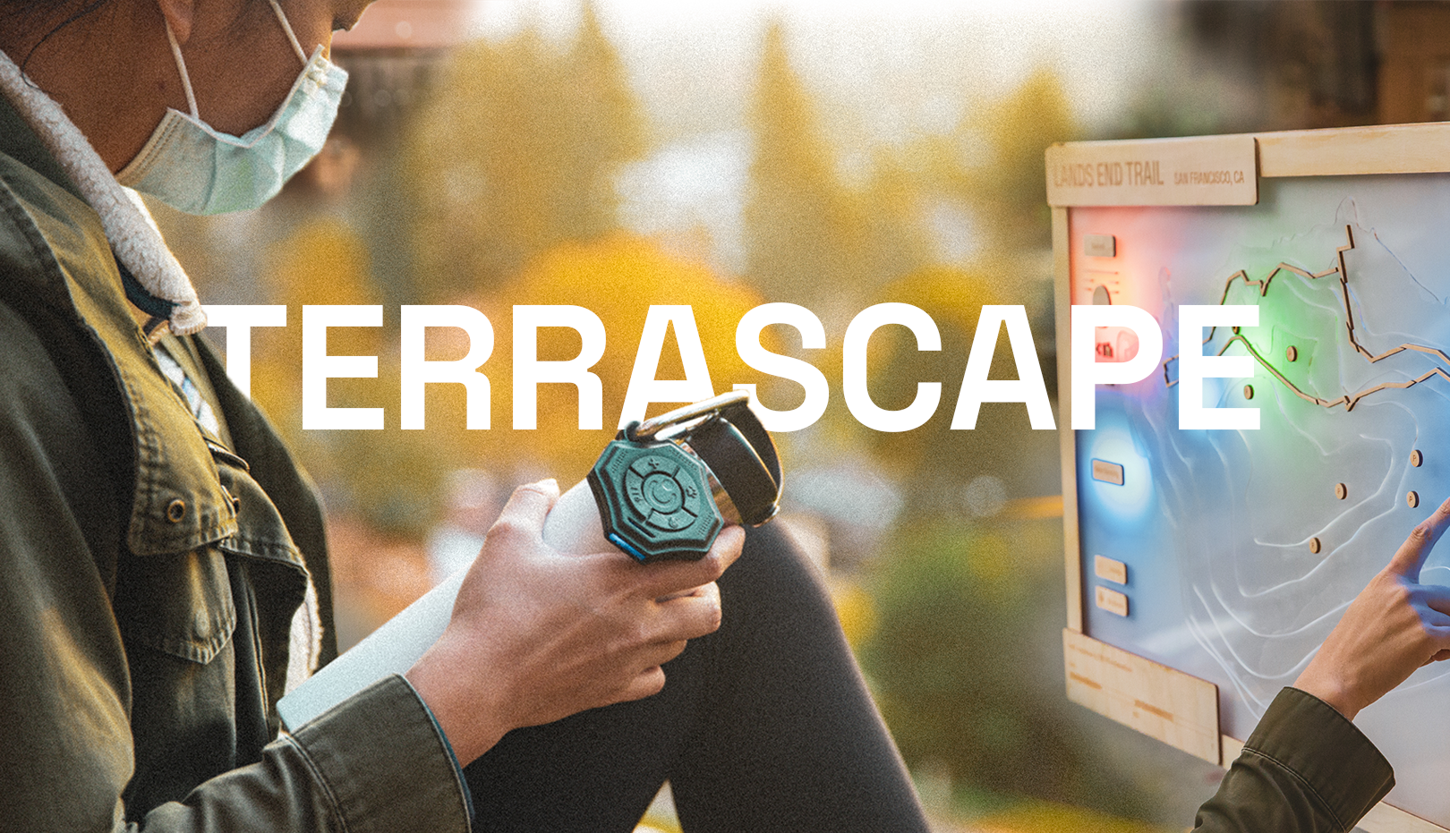
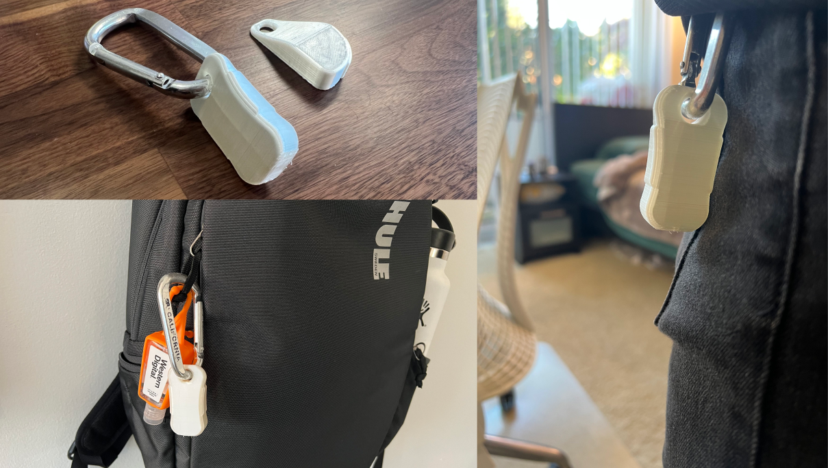
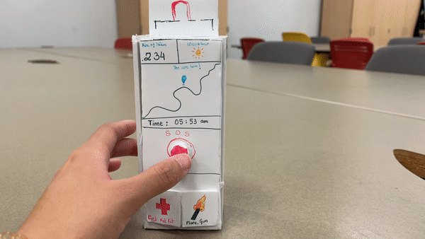
Personal Tracker
A small and portable GPS device able to send emergency signals to relevant social services such as park rangers or the local fire station
Trail Checkpoints
Multiple stations installed throughout trails that monitor hiker activity and provide emergency aid / communication
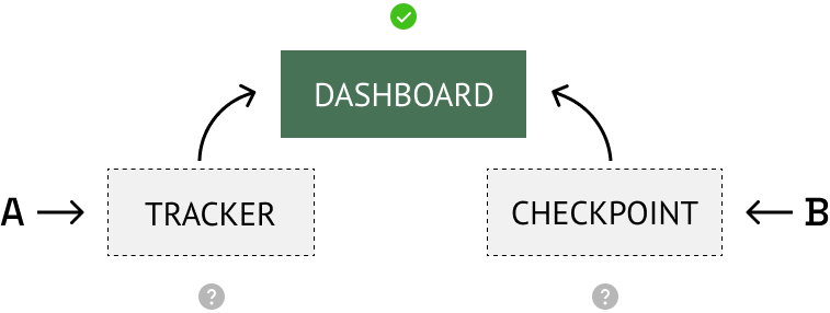
A/B testing between the personal tracker and checkpoint revealed that solo hikers preferred continuous support over sporadic updates. However, they also really liked the idea of having live information displayed at the beginning of the trail. We decided to pursue the personal tracker and dashboard in tandem - the tracker for its safety features and peace of mind, and the dashboard for its ability to display communal and synchronized information.